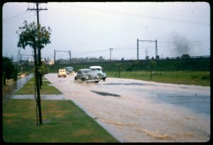
Flooding in Pemberton Street, 1959
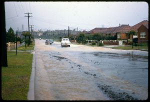
Flooding in Pemberton Street, Strathfield, November 1959. Courtesy Strathfield Local Studies
At its mouth at Botany Bay, Cooks River is a flowing body of water but, in its upper reaches, within the Strathfield LGA, it was once described as ‘a chain of ponds.’ After rain, water holes would fill and often overflow, causing flooding to local streets. A 1930s government Depression scheme began canalling the river in Strathfield during the 1930s, altering its natural flow. By the late 1940s it had been built from Coronation Parade to Water Street, although the stretch from Water Street to Freshwater Park had to wait until the 1960s.
This photo from November 1959, taken from opposite Cosgrove Reserve, shows flooding in Pemberton Street, Strathfield after heavy rain. The railway line is visible in the distance. Out of sight around the bend in the road is the Cooks River, meandering through Strathfield Golf Course. At the time, Pemberton Street joined Ada Avenue but became a dead-end street when Centenary Drive was built during the early 1980s. See: https://strathfieldheritage.com/2018/08/21/opening-of-centenary-drive-strathfield/
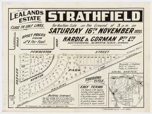
Lealands Estate, Strathfield subdivision plan, 1935. Courtesy State Library of NSW
The western side of this end of Pemberton Street remained sparsely settled until the late 1940s. Lealands Estate had been subdivided and offered at auction on 16 November 1935 although this 1943 aerial photo shows that only one cottage had been built on this section of road by the war.
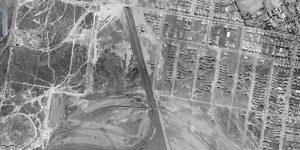
The lone house on the western side of Pemberton Street, Strathfield between Newton Road and Ada Avenue is in the centre of the photo. Cooks River runs through Strathfield Golf Course near the bottom of the photo. Courtesy Six Maps
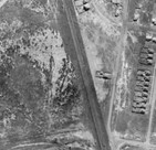
The cottage belonging to Rodney and Violet Bone of 69 (later 67) Pemberton Street, Strathfield, 1943. Courtesy Six Maps.
This home, owned by returned soldier Rodney Ernest Bone, was built on lot 37 of the Lealands Estate and would be the house at the end of the street on the right, near the white car (in the main photo). Rodney Bone married Violet Hutcheson in 1945 and they remained in their cottage here until the late 1970s. Today’s Centenary Drive cuts through their former backyard. Number 65 Pemberton Street now occupies some of the site once owned by the Bone family.
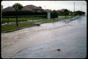
Another view of Pemberton Street’s flooding, November 1959. Courtesy Strathfield Local Studies
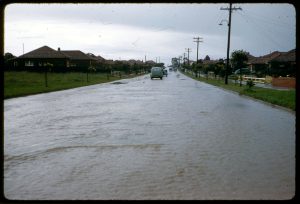
Flooding in Pemberton Street, Strathfield, November 1959, looking towards Newton Road, with Cosgrove Reserve on the left. Courtesy Strathfield Local Studies
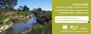
To learn more about the Cooks River’s history, health, biodiversity and conservation please visit the Cooks River: Yesterday, Today and Tomorrow exhibition in the Ironbark Gallery of Strathfield Council Library & Innovation Hub from 14 December 2023 until 11 February 2024. For more information or to attend the official opening, please see: https://www.strathfield.nsw.gov.au/event/cooks-river-yesterday-today-and-tomorrow/
By J.J. MacRitchie
Local Studies Advisor