Bressington Park
About
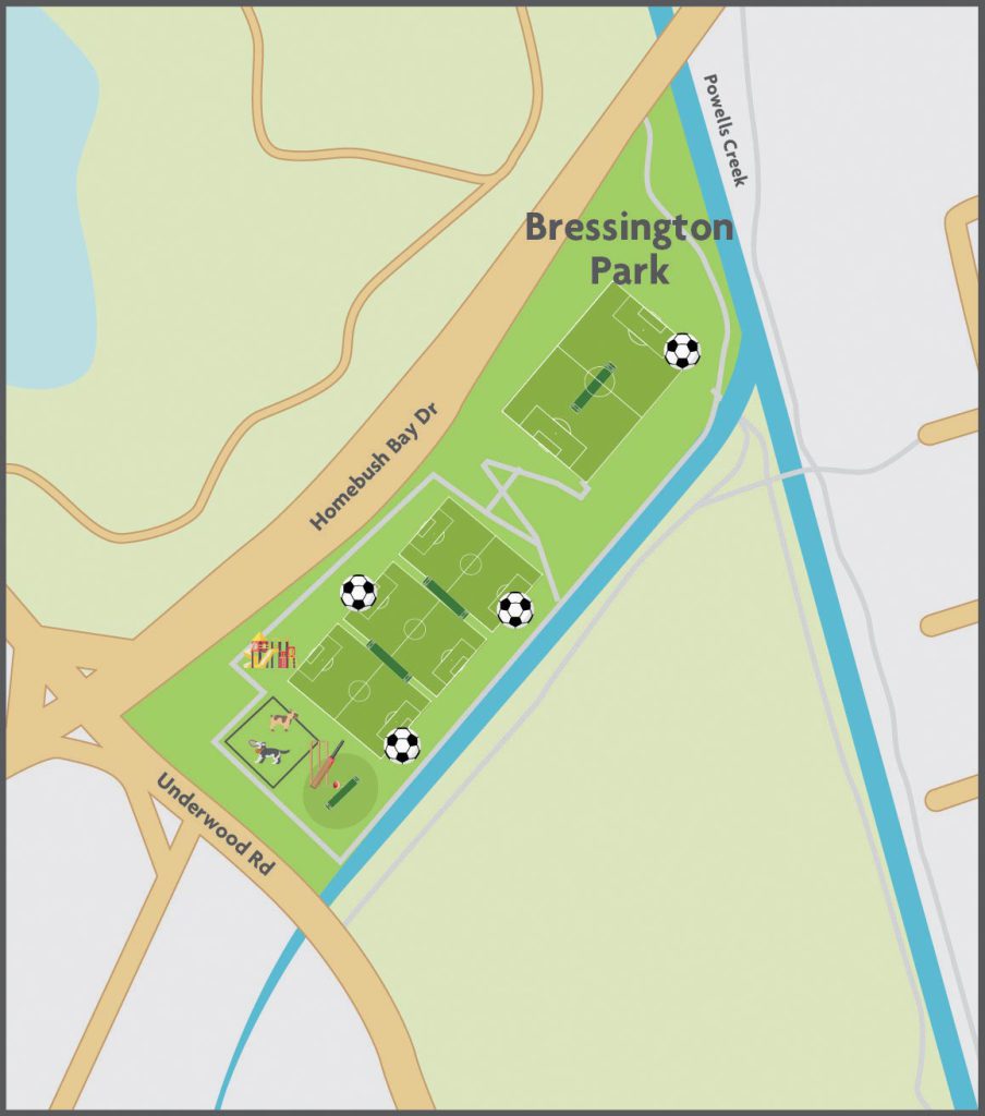
Bressington Park covers 7.9 hectares of land and is a significant park known as the ‘Gateway Park’. Bressington Park provides opportunities for active and passive recreation and links to other significant parks such as Airey Park through the Bay to Bay Cyclepath and Walkway.
Bressington Park is bounded by Powell’s Creek at the east and Saleyards Creek (Canal) at the south. Mason Park Wetlands are located near the rear of the park. Bressington Park is bounded by Homebush Bay Drive at the north and Bicentennial Park, State Sports Centre and Sydney Olympic Park lie to the north. Bressington Park is known as the ‘Gateway Park’ as it also lies on the boundary of Strathfield Council with Canada Bay Council (east) and Cumberland Council (north).
History
Bressington Park was originally a tidal swamp populated by mangroves and was used for many years as a Council tip. The park is named after George Bressington, former Alderman and Mayor of Homebush Council. (Reference: Cathy Jones, Parks Reserves & Memorials, 2004).
Facilities
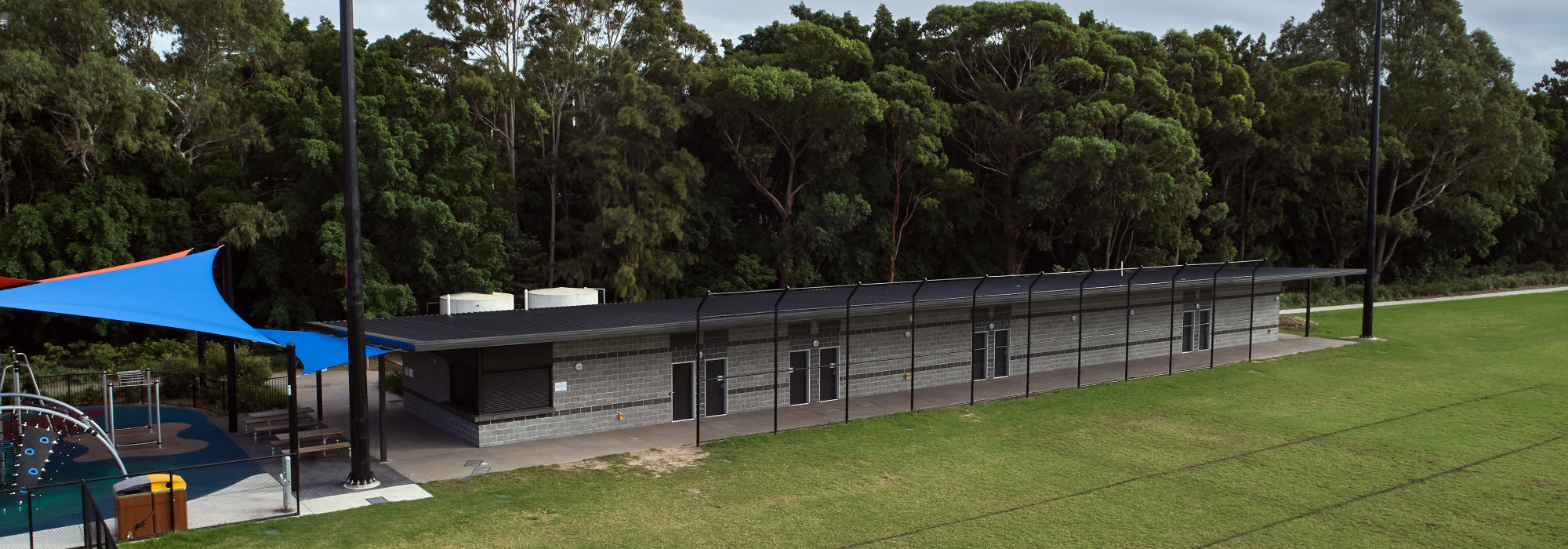
- Amenities block with home and visitors change rooms, a kiosk and public toilets
- 140 space car park
- 3 playing fields (two currently located on the bottom field and one new playing field to be constructed on the top mound)
- Playground
- 4 cricket wickets
- 2 cricket practice wickets
- Fenced off leash dog area
Transport & Accessibility
Bressington Park is on the Bay to Bay Cycle Way! Consider cycling and leave the car at home.
Bus and Train – Transport NSW provides information on public transport including timetables and routes.
Parking is available in the Bressington Park public carpark. Use of the carpark is limited to park users only and is frequently patrolled by Council rangers.